
Earth Science Station
Live seismic and atmospheric monitoring from Bosco’s field station. Data is captured continuously and updated every 5 minutes.
Live Helicorder — Seismic Activity
The helicorder below displays real-time ground motion data recorded by the station seismograph. Each horizontal line represents 30 minutes of data; time runs left to right, top to bottom. Darker traces indicate stronger ground motion.
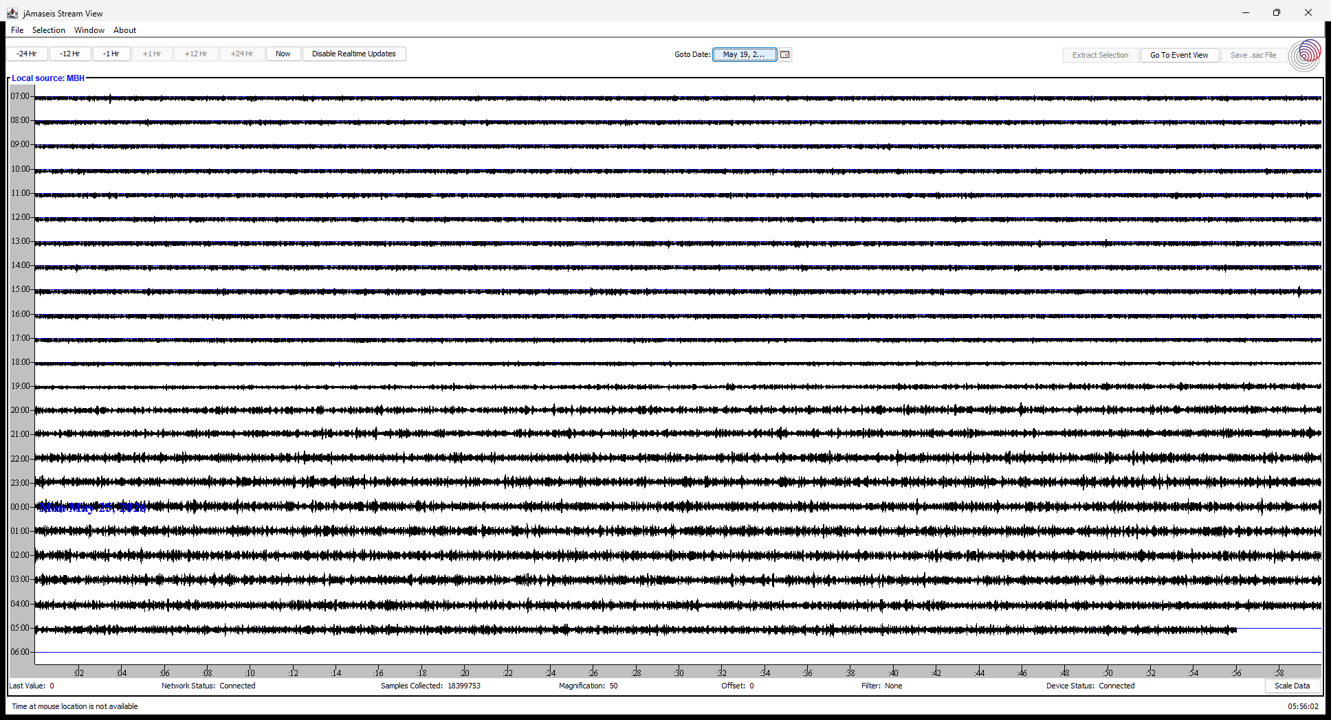
🟢 Live · Updates every 5 minutes · Loading…
Station Specifications
| Instrument | Windows seismograph (helicorder pipeline) |
| Data format | Helicorder image (PNG), 24-hour rolling window |
| Update interval | Every 5 minutes via automated upload |
| Upload path | /wp-content/seismo/helicorder.png |
| Pipeline | C:\seismo\helicorder-upload.ps1 (Windows Task Scheduler) |
About the Station
The Earth Science Station is a personal monitoring setup designed to capture ambient seismic activity and atmospheric conditions. The seismograph runs continuously on a dedicated Windows machine, generating a helicorder image that is automatically uploaded to this site every five minutes using a PowerShell script scheduled via Windows Task Scheduler.
The helicorder image at /wp-content/seismo/helicorder.png is overwritten in place with each upload cycle. This page auto-refreshes the image client-side every 5 minutes to match the upload cadence — no page reload required.
Earth Science Station
Live seismic and atmospheric monitoring from Bosco’s field station. Data is captured continuously and updated every 5 minutes.
Live Helicorder — Seismic Activity
The helicorder below displays real-time ground motion data recorded by the station seismograph. Each horizontal line represents 30 minutes of data; time runs left to right, top to bottom. Darker traces indicate stronger ground motion.
🟢 Live · Updates every 5 minutes · Loading…
Station Specifications
| Instrument | Windows seismograph (helicorder pipeline) |
| Data format | Helicorder image (PNG), 24-hour rolling window |
| Update interval | Every 5 minutes via automated upload |
| Upload path | /wp-content/seismo/helicorder.png |
| Pipeline | C:\seismo\helicorder-upload.ps1 (Windows Task Scheduler) |
About the Station
The Earth Science Station is a personal monitoring setup designed to capture ambient seismic activity and atmospheric conditions. The seismograph runs continuously on a dedicated Windows machine, generating a helicorder image that is automatically uploaded to this site every five minutes using a PowerShell script scheduled via Windows Task Scheduler.
The helicorder image at /wp-content/seismo/helicorder.png is overwritten in place with each upload cycle. This page auto-refreshes the image client-side every 5 minutes to match the upload cadence — no page reload required.